| Cover | Title | Publisher(s) | Publishing Year | Synopsis | Dossier | Theme |
|---|---|---|---|---|---|---|
 |
Overview of Gender Actors & Interventions in Lebanon - لمحة عامة عن الأطراف الفاعلة في مجال الجندر وتدخلاتها في لبنان | Lebanon Support | 2016 |
This report aims to present a general overview of the current local gender actors and their interventions... [read more] |
Women's rights and status, Gender Equity Network | Gender |
 |
The conflict context in Beirut: the social question, mobilisations cycles, and the city’s securitisation | Lebanon Support | 2015 |
This report provides an analysis of the history and current situation of the conflict context, actors and dynamics in Beirut, Lebanon. The report seeks to shed light on the main actors, topics of... [read more] |
Conflict Analysis Project | Conflict Resolution |
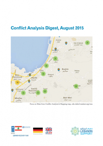 |
Conflict Analysis Digest, August 2015: Politics of security, discourses of fear and economic fatigue: the conflict dynamics in Matn | Lebanon Support | 2015 |
This Conflict Analysis Digest is composed of: I. Current conflict trends 1- Overview of mapped conflict incidents in Lebanon, with the villages where... [read more] |
Migration, Mobility and Circulation, Conflict Analysis Project | Refugees, Conflict Resolution |
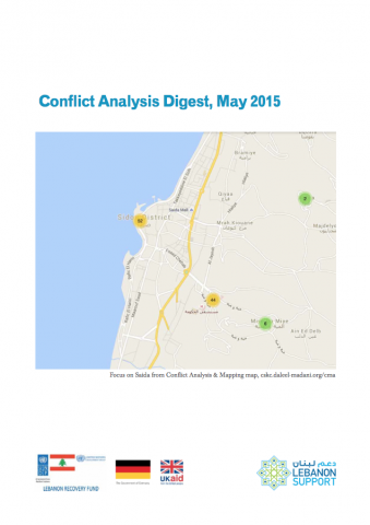 |
Conflict Analysis Digest, May 2015: Spatial Fragmentation and rise in poverty. The conflict context in Saida | Lebanon Support | 2015 |
|
Conflict Analysis Project | Conflict Resolution |
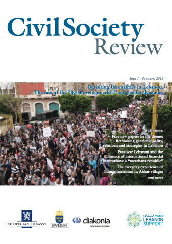 |
Civil Society Review issue 1 - Revisiting Inequalities in Lebanon: the case of the "Syrian refugee crisis" and gender dynamics | Lebanon Support | 2015 |
The objective of the Civil Society Review is to bring civil society practitioners, experts, activists, and researchers together to develop knowledge, as well as to innovate new tools and practices... [read more] |
Migration, Mobility and Circulation, Gender Equity Network, Civil Society Resources | Refugees, Gender |
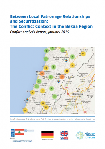 |
Between Local Patronage Relationships and Securitization: The Conflict Context in the Bekaa Region | Lebanon Support | 2015 |
This report provides an analytical summary of the conflict context in the Bekaa region of Lebanon, with a focus on the relationships between the Syrian de facto refugees and the... [read more] |
Migration, Mobility and Circulation, Conflict Analysis Project | Refugees, Conflict Resolution |
| Mapping of The Lebanese 2009 Elections | Lebanon Support | 2010 |
This package includes 3 maps pertaining to Lebanon's 2009 elections: - "confessional-distrib": showing the confessional geographic distribution of Lebanon's population - "election-results":... [read more] |
Elections | ||
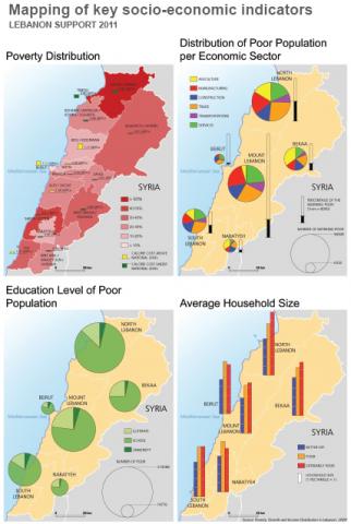 |
Mapping of Key Socio-Economic Indicators | Lebanon Support | 2011 |
Four maps showing poverty distribution, distribution of poor population per economic sector, education level of poor population, and average household size, across Lebanon. |
Social & Cultural Development, Economic Development | |
| Report on Psycho-social Support to Returnees and Communities Affected by War | Lebanon Support | 2006 |
This list is a compilation of activities that fall into the psycho-social support sector, showing the type of support, location, and partners. |
The July, 2006 Israeli War on Lebanon | Mental Health & Psychosocial | |
| Mapping of Open Businesses in Nahr El Bared's Adjacent Area | Lebanon Support | 2009 |
Maps of businesses open in Nahr El Bared's adjacent area including food production businesses, construction and hardware industries, beauty and entertainment enterprises, and health, education and... [read more] |
The Nahr El-Bared War | Trade & Finance |
![]()
![]()
The Open Library Project
The Open Library Project is an online resource library with readily available reference books, reports, studies, guides and tools, and fact sheets relevant to civil society and civil society organisations’ work in Lebanon.
All copyright are reserved under The Centre for Social Sciences Research & Action / Lebanon support © 2025.
The Centre for Social Sciences Research & Action is registered in Cyprus as a non-profit Limited Liability Company under registration number HE421100.
By virtue of an MOA, Lebanon Support (registered in Lebanon under number 168) implements all activities and projects in Lebanon under the name of Centre for Social Sciences Research & Action.