Lebanon, a year in conflict.
Publication Date:
April, 2016
Period Covered:
January, 2015 to December, 2015
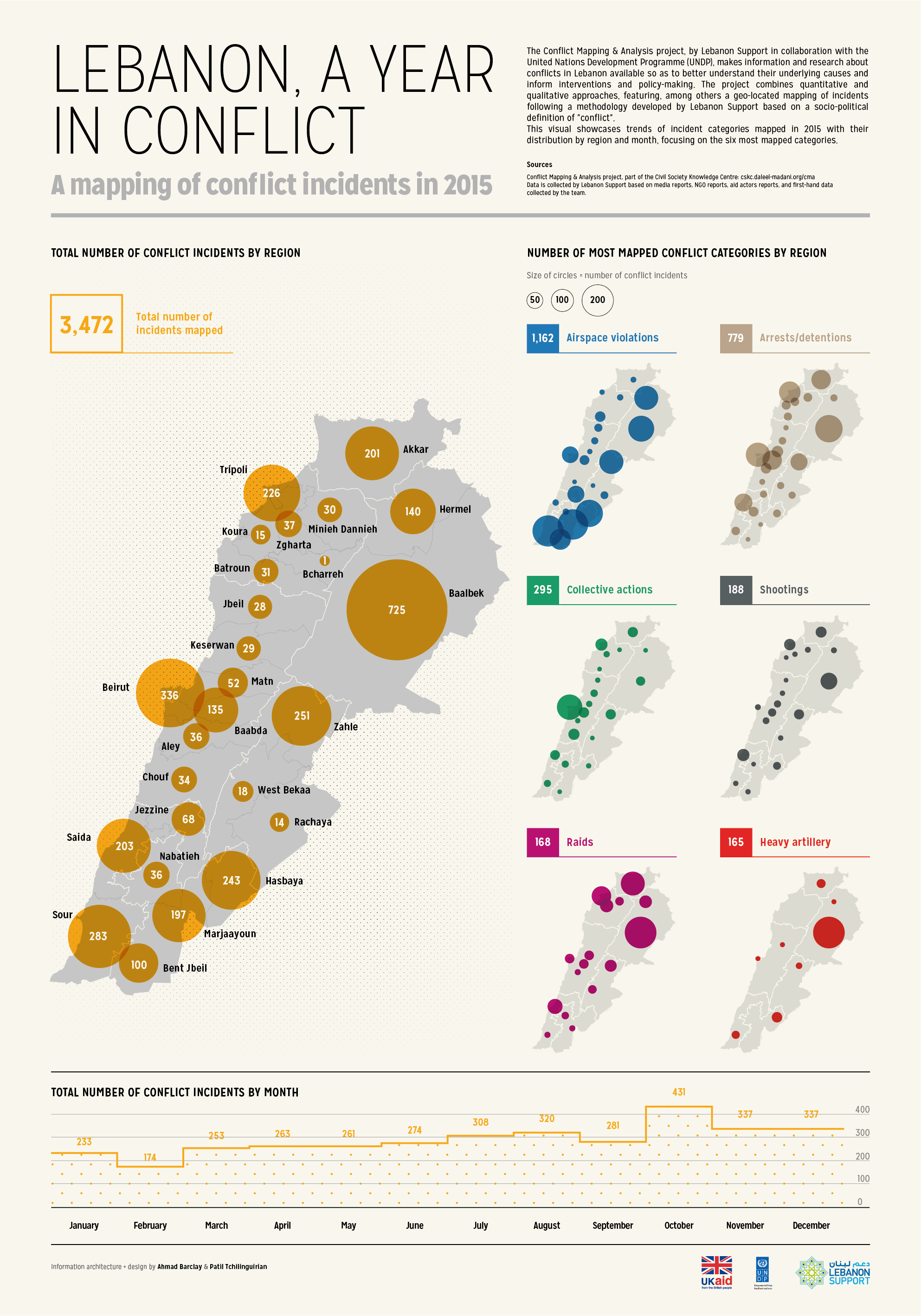
This visual showcases trends of incident categories mapped in 2015 with their distribution by region and month, focusing on the six most mapped categories which are: Airspace violations, Arrests/detentions, Collective actions, Shootings, Raids, Heavy Artillery.
It is part of a series of three visuals published by Lebanon Support in April 2016, which includes the visuals: Armed conflicts in Lebanon and Lebanon's State response to illicit activities.
Lebanon, a year in conflict. A mapping of conflict incidents in 2015
Information architecture + design by Ahmad Barclay & Patil Tchilinguirian
Dossier:
Conflict Analysis Project