Power & Governance Conflicts Mapped in Tripoli
Publication Date:
August, 2016
Period Covered:
July, 2014 to June, 2015
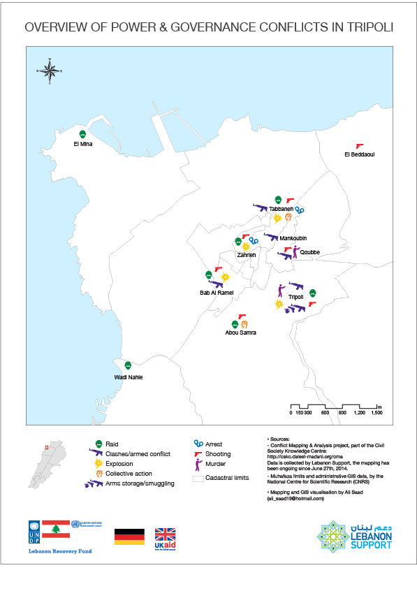
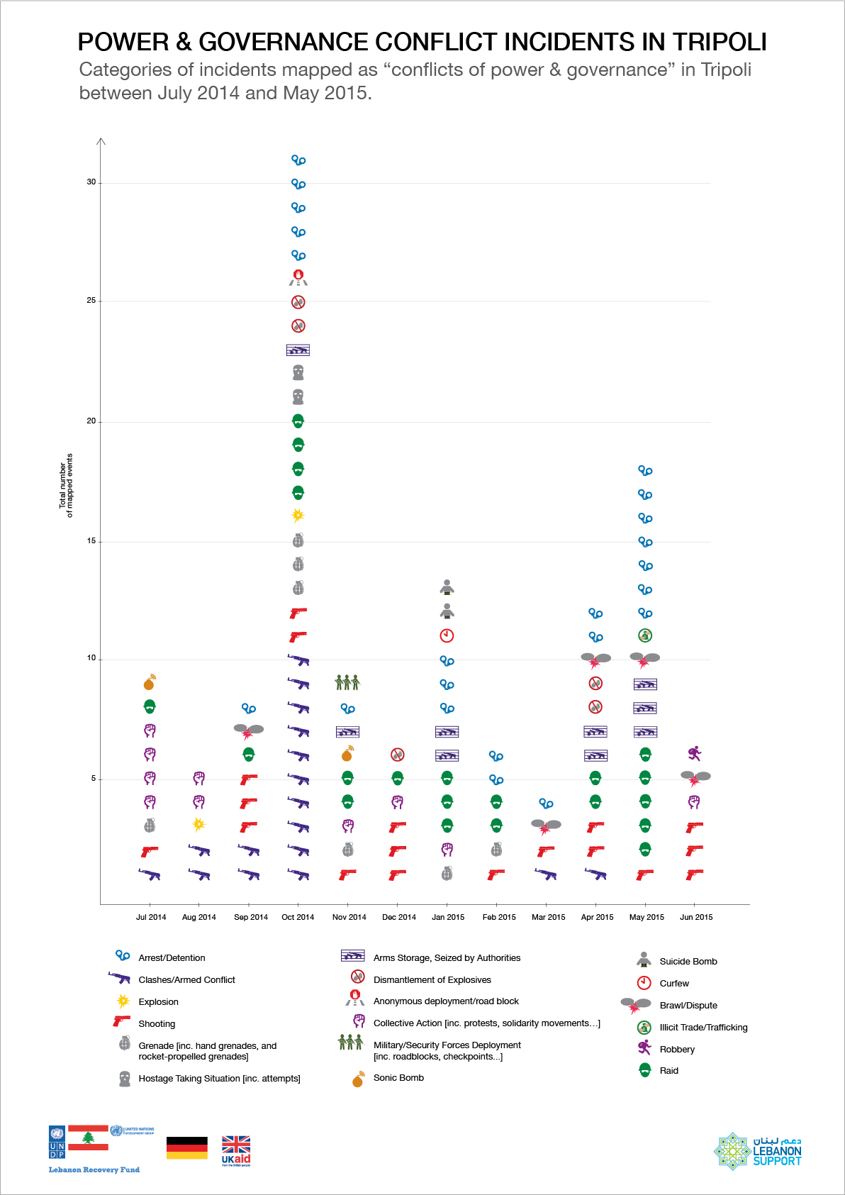
These visuals look into incidents mapped in Tripoli as "Power & goevrnance conflicts" between July 2014 and June 2015. The first one details the kinds of incidents mapped, and highlights the frequency of each per month. While the map gives an overview of the main incidents and their respective locations.
Overview of Power & Governance Conflict Incidents in Tripoli

Mapping and GIS visualisation by Ali Saad
Dossier:
Conflict Analysis Project
Embed this content:
Copy and paste this code to your website.


