2015-2018: Four Years in Review - Mapping of Conflict Incidents in Lebanon
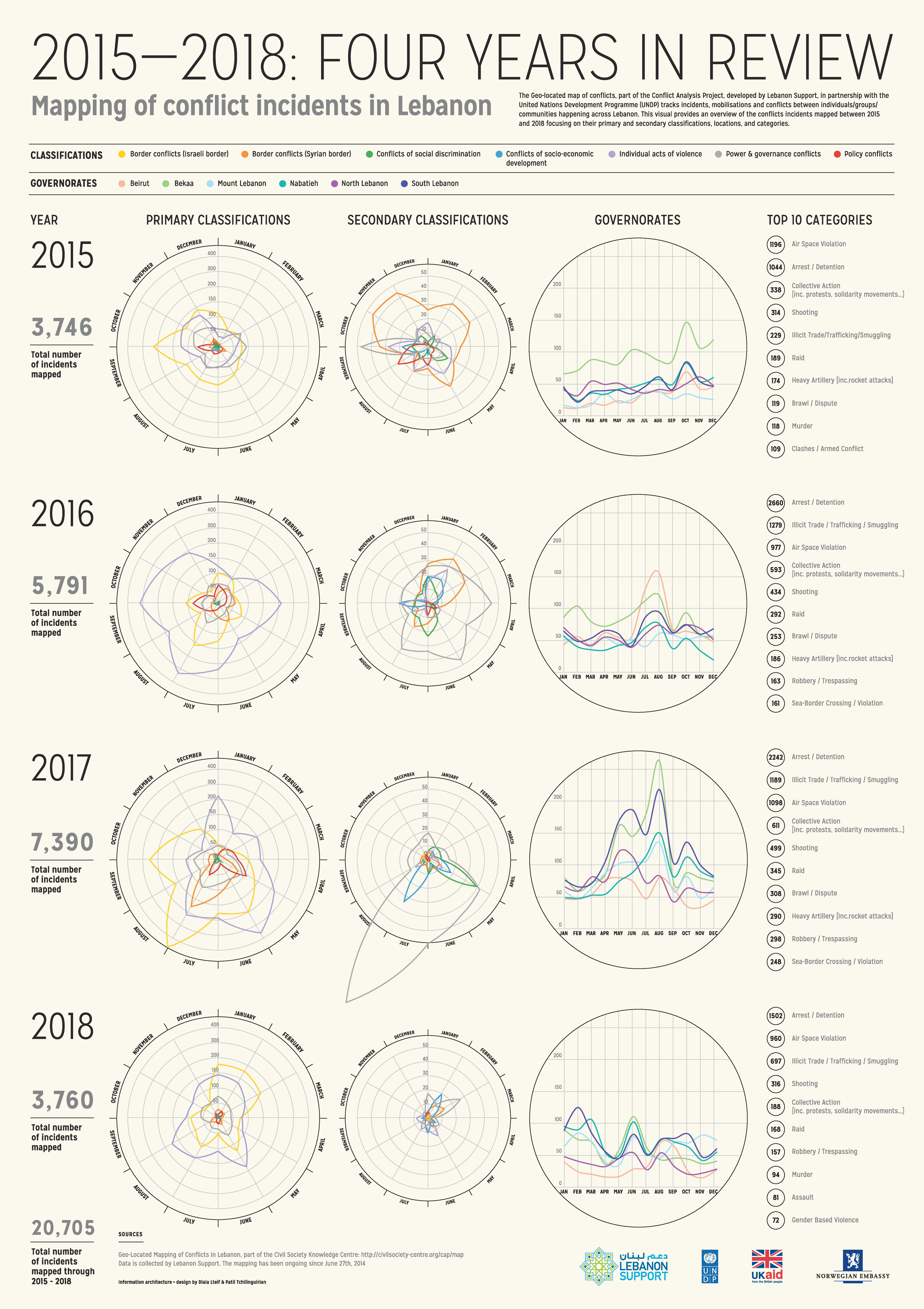
The Geo-located map of conflicts, part of the Conflict Analysis Project, developed by Lebanon Support, in partnership with the United Nations Development Programme (UNDP) tracks incidents, mobilisations and conflicts between individuals/groups/communities happening across Lebanon. This visual provides an overview of the conflicts incidents mapped between 2015 and 2018 focusing on their primary and secondary classifications, locations, and categories.
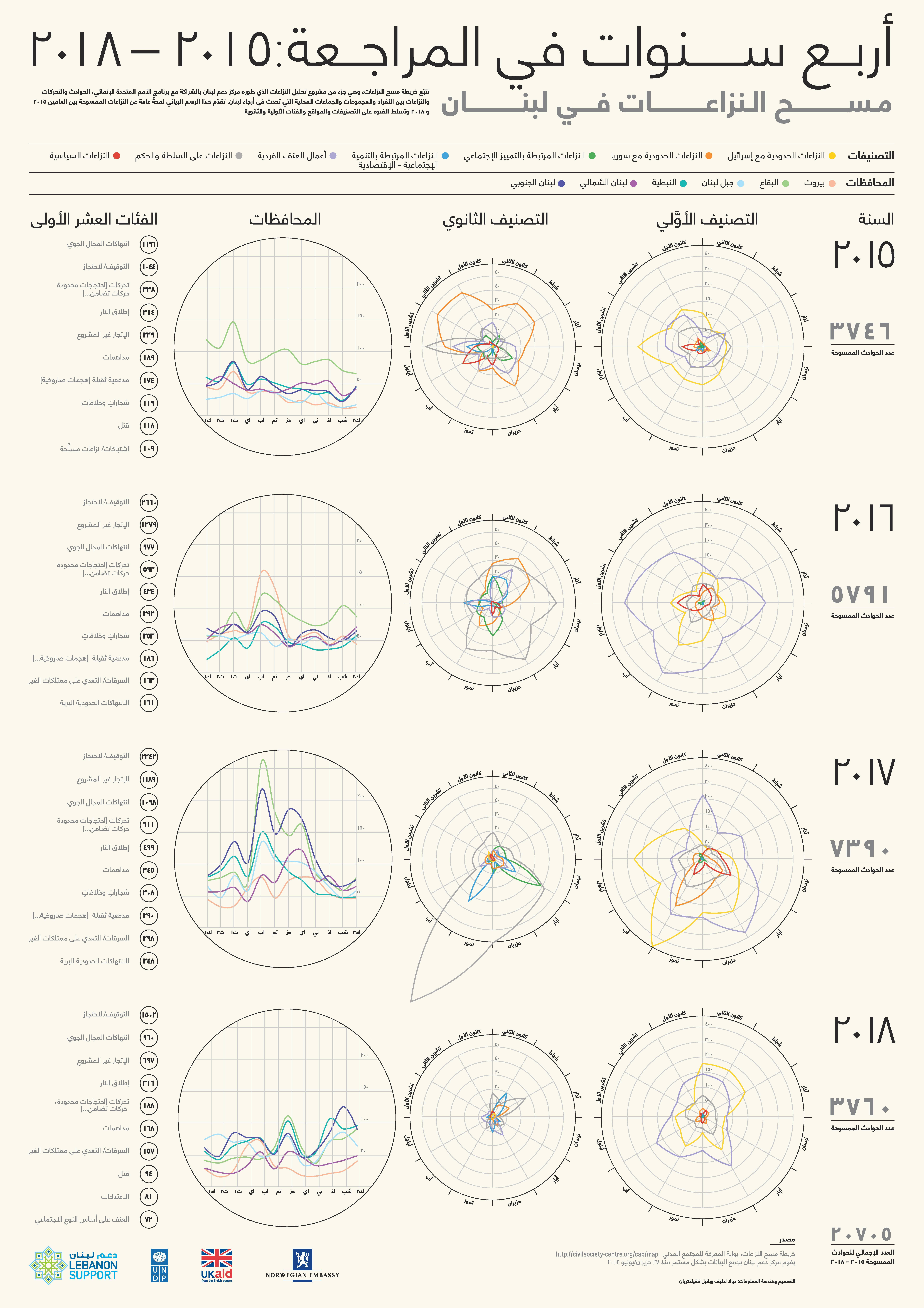
تتبّع خريطة مسح النزاعات، وهي جزء من مشروع تحليل النزاعات الذي طوره مركز دعم لبنان بالشراكة مع برنامج الأمم المتحدة الإنمائي، الحوادث والتحركات والنزاعات بين الأفراد والمجموعات والجماعات المحلية التي تحدث في أرجاء لبنان. يقدّم هذا الرسم البياني لمحةً عامة عن النزاعات الممسوحة بين العامين ٢٠١٥ و ٢٠١٨، ويسلط الضوء على التصنيفات والمواقع والفئات الأولية والثانوية.
2015-2018: Four Years in Review - Mapping of Conflict Incidents in Lebanon

Conceived and designed by:
Patil Tchilinguirian & Diala Lteif
Read More at: https://civilsociety-centre.org/content/crackdown-social-media-lebanese-authorities-en-arCopyright ©Lebanon Support
Read More at: https://civilsociety-centre.org/content/crackdown-social-media-lebanese-authorities-en-arCopyright ©Lebanon Suppor
أربع سنوات في المراجعة: 2015-2018 - مسح النزاعات في لبنان

تخطيط وتصميم:
باتيل تشيلينغريان وديالا لطيف

