Air space violations by Israeli Military across Lebanon
Publication Date:
October, 2015
Period Covered:
July, 2014 to May, 2015
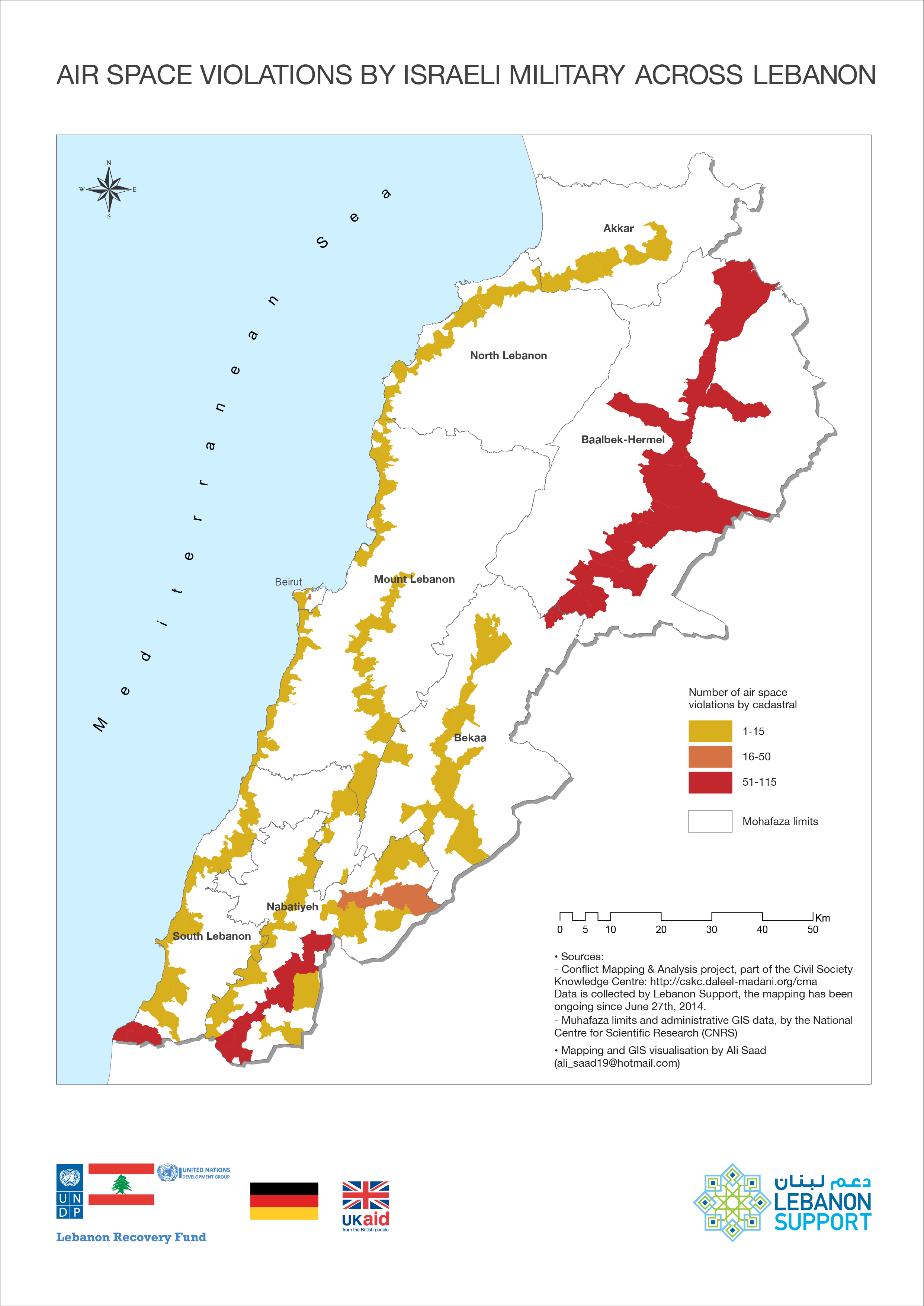
This map visualises the instances of air space violations in Lebanon made by the Israeli military, analysing the original data in order to extrapolate the flight trajectory between the locations where the violation was recorded and reported. These breaches of Lebanese sovereignty happen so regularly that they become overlooked. However, the map shows that Israeli airplanes overfly all cazas of the country from South to North, with a higher concentration in the border areas of the South (specifically Nabatieh), and Baalbeck.
Air space violations by Israeli Military across Lebanon
Mapping and GIS visualisation by Ali Saad
Dossier:
Conflict Analysis Project