Overview of Incidents on the Lebanese South Border
Publication Date:
August, 2016
Period Covered:
July, 2014 to June, 2015
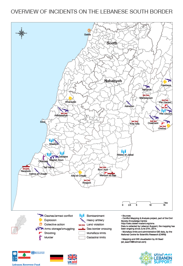
This map offers a quick overview of some of the main conflict incidents mapped on as "Border conflict (Israeli border)", without taking into considerationa airspace violations which are addressed in more details in this heatmap.
Overview of Incidents on the Lebanese South Border
Mapping and GIS visualisation by Ali Saad
Dossier:
Conflict Analysis Project